Anchor

Creates a topographical terrain, represented by triangulated network. You can create a terrain from scratch, or import coordinates from a file.
- Activate Terrain, and click points to define the outer boundary (or enter coordinates in the Coordinate Fields). As you click points, the surface triangulates.

- Continue defining the outer boundary.

- Define interior points as well. Each point you define will become a node you can edit. You do not need to define all nodes now; you can add nodes later.

- Open the terrain's Properties to the Landscape page. Under Smooth, increase the Level.

This increases the level of triangulation, resulting in a more accurate surface.

- Activate the Edit Tool on the terrain. Each point you defined when creating the terrain is represented as a node.

Note: For details on this tool, see Edit Tool. - If you want to add more nodes, right-click where you want the new node and select Add Node.

- To modify the terrain, click a node and use the Coordinate Fields to change its Z position. You can also drag a node while in a Front or Side view. Adjacent nodes will remain in place.

- You can also change the elevation of nodes along the boundary.

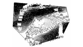
- Switch to World Plan. This view shows the terrain as a series of
Anchor Xure124014 Xure124014 isolines, each labeled with its elevation.

- In the Landscape page, change the Step. In this example, an isoline will be displayed every 12 inches.

This makes the isoline display less dense.

- Uncheck Label.

This removes the elevation value from each isoline.

- Uncheck Visible.

This removes the isoline display.

If isolines are displayed, when you move out of World Plan view, they will not be visible.