/
GeoWalk
GeoWalk
- Rip Fowler (Unlicensed)
Owned by Rip Fowler (Unlicensed)
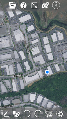
GeoWalk tracks your location in a CAD drawing using GPS. The blue you are here icon marks your current location.
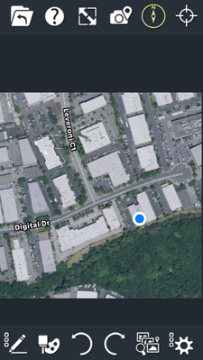
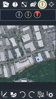
Toggle on GeoMark by tapping the compass icon near the top of the screen.
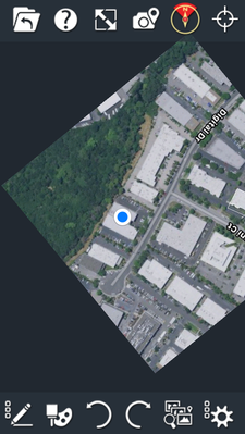
Heads up mode orientates the drawing in the direction you are facing.
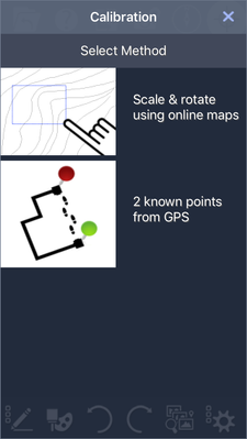
To use GeoWalk you must first calibrate your drawing, by inserting a GPS map or picking two relative points.
When using a live GPS map (.MAP file) GeoWalk is on by default and requires no calibration.
For more on GeoWalk watch the video below.
Features discussed in this article are available in the following products: TurboSite, TurboSite Plus and TurboSite Pro
Related Pages
Related content
Geo-Location
Geo-Location
More like this
Geo-Location
Geo-Location
More like this